
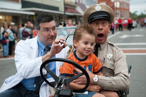
Motorcycle Rides Near Mount Airy, NC
The following rides all start at the parking lot for the Andy Griffith Playhouse/And Griffith Museum, at 218 Rockford Street, Mount Airy, NC 27030.
ORCHARD GAP RIDE
Turn left out of the parking lot of the Andy Griffith Playhouse. Turn on the 1st road to the left past the Playhouse. At the 1st stoplight, turn right onto Pine Street/Highway 89. Go to the 3rd stoplight and turn left. Travel the twisty road until it dead ends onto the Blue Ridge Parkway. Turn left onto the Blue Ridge Parkway traveling south. Exit at the Highway 52 south exit and travel back to Mount Airy. At the Highway 52/601 intersection, turn left onto Highway 601/Rockford Street and travel back to the Andy Griffith Playhouse.
SCENIC BLUE RIDGE PARKWAY RIDE
(approximately 50 miles)
Turn right out of the Andy Griffith Playhouse parking lot. Travel to the intersection of Highway 601/52. Turn right onto 52 North to the Blue Ridge Parkway. Travel south on the Parkway to the Highway 89 intersection. Turn onto Highway 89 toward Mount Airy. Travel Highway 89 back to the Andy Griffith Playhouse parking lot on your left.
PILOT MOUNTAIN STATE PARK RIDE
(approximately 35 miles)
Turn right out of the Andy Griffith Playhouse parking lot. Travel to the intersection of Highway 601 and Highway 52. Turn left onto Highway 52 South to the exit for the Pilot Mountain State Park. Travel up the twisty road tot he top for scenery second to none! Travel back to Mount Airy on Highway 52 North and take a right at the Highway 52/89 intersection onto Highway 89/Rockford Street and head back to the Andy Griffith Playhouse.
LOVER’S LEAP RIDE
(approximately 75 miles)
Turn left out of the Andy Griffith Playhouse parking lot. Turn left at the first street, Graves Street. At the first stoplight, turn right onto Pine Street. Continue on this road past the Virginia state like to the stop sign (several miles). Turn left at the stop sign toward Stuart, Virginia. Go straight under the stoplight in Stuart to the next stop sign. Turn left onto Highway 58. Stay on Highway 58 for several miles. You will pass Lover’s Leap. Continue to the Blue Ridge Parkway intersection. Travel south on the parkway to the Highway 52 intersection to Mount Airy. Travel Highway 52 South to the 52/601 intersection. Take a left onto Highway 601/Rockford Street back to the Andy Griffith Playhouse.
MAYBERRY RIDE
This 50-mile route is one of the most popular rides to take a step back to a simpler time and enjoy a variety of roads, scenery and stops along the way.
Stop 1 – The Andy Griffith Playhouse
Directions to Stop 2 – Leaving the Andy Griffith Playhouse, take a right out of the parking lot on to South Rockford Street, travel 0.9 miles to Highway 52. Take a left onto Highway 52 South and go 10.5 miles to Exit 134 (Highway 268). Neighbors/Citgo will be on the right at Exit 134. Get yourself a bottle of pop and gas up!
– Distance to Stop 2: 11.4 miles
Stop 2 – Neighbors/Citgo (Pilot Mountain)
Directions to Stop 3 – Leaving Neighbors/Citgo, take a right on Highway 268 in front of Neighbors traveling 9.7 miles to Copeland School Road. Take a left on Copeland School Road traveling 2.8 miles to Old Rockford Road. Travel 3.2 miles on Rockford Road to the stop sign. Rockford General Store will be located across the street from the stop sign. Step inside and speak to Paul and Carolyn. Drink a root beer or Nehi Peach and enjoy a variety of old timey candies as well as their new grill.
– Distance to Stop 3: 15.7 miles
Stop 3 – Rockford General Store
Directions to Stop 4 – Leaving Rockford General Store, travel north on Rockford Road 5.7 miles to stop sign. Go straight through stop sign 3.4 miles to Highway 601. Take a right on Highway 601 traveling 9.1 miles to stop light at Highway 52. Take a left at the light onto Highway 52 North and travel 1.8 miles to Goobers-52 located on the right just past Mayberry Mall.
Stop 4 – Aunt Bea’s
Directions to Stop 5 (Final Destination) – Leaving Aunt Bea’s Restaurant, take a right Onto Hwy 52 North traveling 0.8 miles to Starlite Road. Take a right onto Starlite Road 0.2 miles to stop sign. Take a right at the stop sign onto West Lebanon Street traveling 1 mile to stop light. Take a right at the stop light onto North Main Street traveling 0.2 miles bearing right onto North Main Street. Continue traveling 0.5 miles through downtown until you see the Municipal Building on the right. Take a right into the driveway just past the Municipal Building to enter the parking lot located behind the Municipal Building.
Distance to Stop 5 is 2.9 Miles