


March 17, 2021
15 Highlights of the Mountains-to-Sea Trail in Western North Carolina
Sign up for our newsletter to stay in the know on Mount Airy news and events.
The Mountains-to-Sea Trail (a.k.a. the MST) stretches from North Carolina’s western border with Tennessee all the way east to the Atlantic Ocean. This epic NC hiking trail passes through 37 different counties, three national forests, and 10 North Carolina State Parks. Stretching from Clingmans Dome in Great Smoky Mountains National Park to Jockey’s Ridge in the Outer Banks, the MST covers 1175 miles. The trail takes hikers to both the highest mountain peak and the highest sand dune east of the Colorado Rockies. The Mountains-to-Sea Trail currently consists of over 700 miles of footpaths, connecting the dots between them with temporary routes along backroads and existing bike paths. This beloved pilgrimage through the Blue Ridge Mountains and beyond was hand-crafted by devoted volunteers. North Carolina’s longest trail is split into 18 segments and three sections--the Mountains, the Piedmont, and the Coastal Plains/Outer Banks. In other words, the MST runs the gamut of what North Carolina has to offer in terms of wilderness, off-the-beaten-path communities, and wide-open skies.
Here are the highlights of the trail’s Western North Carolina section, from the state’s boundary to the famous Pilot Mountain. Note that this covers just the first six segments of this epic trek.
The first section of the MST traverses 46.8 miles (34.7 of which is on trails), starting from Clingman's Dome and ending at Waterrock Knob. Incidentally, these two spots are the main highlights of this segment of the trail, which also includes several gorgeous waterfalls, historic sites, and a museum.
(Photo by Clingmans Dome in Great Smoky Mountains National Park, photo via Canva)
The highest peak in Great Smoky Mountains National Park (the most visited national park in the country), Clingmans Dome measures in at 6,643 feet. At the top, it has an awesome observation deck that lifts visitors above the tree line for expansive vistas in all directions. On clear days, visibility can reach up to 100 miles, and Clingmans Dome is the highest point in Tennessee, as well as the highest point on the Appalachian Trail. It is usually listed as either the 2nd or 3rd tallest mountain east of the Mississippi River.
(Photo by Sunrise at Waterrock Knob, photo by pmuellr via CC BY 2.0)
Another mountain summit that surpasses 6,000 feet, Waterrock Knob is renowned for its spectacular sunrises and sunsets. The view from the top offers a 360-degree panorama that allows visitors to see four states on clear days. It provides an excellent overview of eight different mountain ranges– the Great Smokies, Great Balsams, Newfound, Blacks, Craggies, Blue Ridge, Nantahala, and Cowee. The Waterrock Knob Overlook is located at Blue Ridge Parkway milepost 451.2, and offers a visitor center with information and exhibits. The Waterrock Knob Trail is also the southernmost hiking trail on the BRP.
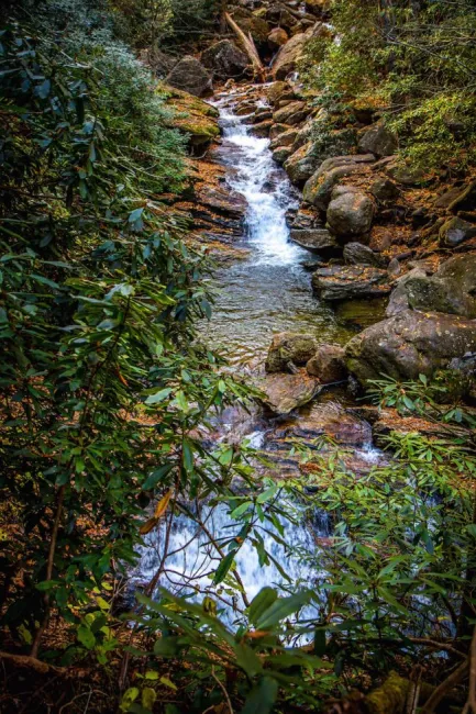
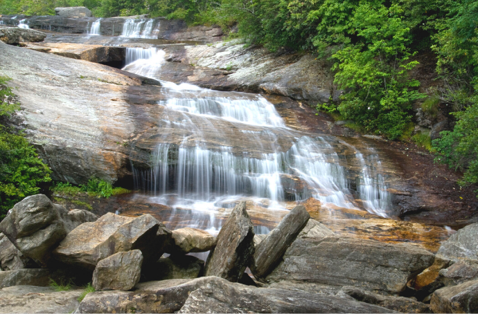
The second section of the MST stretches to 63.6 miles, with nearly 60 of that being true hiking trails. The route takes hikers from Waterrock Knob into Nantahala National Forest and Pisgah National Forest, and finally culminates at the Historic Pisgah Inn. This portion of the hike is perfect for anyone who loves waterfalls!
(Photo by Skinny Dip Falls, photo by Bret Love & Mary Gabbett)
A beloved swimming hole for locals, Skinny Dip Falls invites overheated hikers to pull off their boots for a while and cool down in the pool. It’s located right off the Blue Ridge Parkway near the Looking Glass Rock Overlook (at milepost 417), one of the most popular spots along the 469-mile route. While its name is considerably wilder than what’s legally allowed at the falls, there is a nice rock to jump from and plenty of spots to wade around and relax in a tranquil paradise.
(Photo by Graveyard Fields Lower Waterfall by jadimages via canva)
Ubiquitously listed as one of the top five spots on the Blue Ridge Parkway and/or near Asheville, Graveyard Fields offers magnificent hiking with flower-lined walking paths and top-tier waterfalls. The fields, which were named for tree stumps that remained after a severe wind storm in the 1920s, have been slow to regrow into forests, so they offer up lots of sunshine and swimming. Graveyard Fields is also highly regarded for its wild blueberries, which in turn attract wild Black Bears. So it’s worth paying attention if the berries are in season, both for tasty treats and for your safety.
Spanning 71.4 miles from the Pisgah Inn to the Black Mountain Campground, the third section of the Mountains-to-Sea Trail includes the highest spot in North Carolina, as well as one of its most popular tourist destinations: Asheville.
(Photo by Emma Gallagher)
At Milepost 384, the Blue Ridge Parkway Visitors Center & Headquarters are right outside of Asheville.
Visitors can watch a 24-minute film (The Blue Ridge Parkway: America’s Favorite Journey), explore exhibits about the history and culture of the Blue Ridge Mountains, and tour the LEED-certified green building. This is the place to get your Blue Ridge Parkway souvenirs and talk to rangers about the top spots on the BRP. It’s also a good place for a short, 1.2-mile loop hike that provides easy access to the MST.

(Photo by TheMachinePhotography via CC BY 2.0)
Craggy Gardens is located at Milepost 364. It’s famed for its gnarly rhododendrons and their spring blooms, as well as a place to catch spectacular sunrises and sunsets. Set at a lofty 5500 feet, Craggy Gardens provides 360º vistas galore, including glimpses of Tennessee and an up-close-and-personal view of the massive Mount Mitchell. Needless to say, this is a fantastic place for a picnic! “The Craggies” is really one of the most beloved sections of the Blue Ridge Parkway.
(Photo by View from the Summit of Mount Mitchell, photo by Bret Love & Mary Gabbett)
Literally the highest point east of the Mississippi, Mount Mitchell is the tallest mountain in North Carolina and the entire Eastern United States. The namesake feature of Mount Mitchell State Park, the mightiest mountain in the East is part of the Black Mountain subrange and is located less than 20 miles from downtown Asheville. Summiting Mount Mitchell is most often done by car, but there are a few brave souls who do it solely by foot. The MST helps trekkers to accomplish this goal.
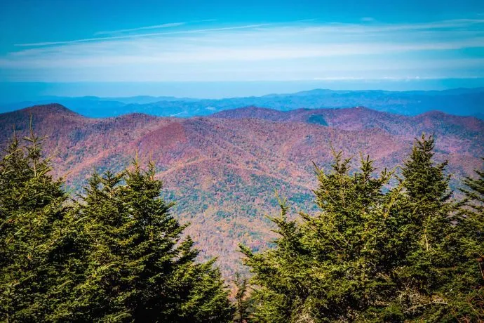
Segment 4 of the Mountain-to-Sea Trail extends 75.3 miles, from the Black Mountain Campground at the foot of Mount Mitchell all the way to the Beacon Heights Overlook on the Blue Ridge Parkway (milepost 305.2).
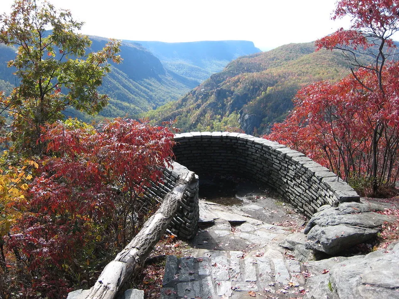
(Photo by Linville Gorge Wiseman’s View by msprague is licensed under CC BY-SA 2.0)
A yard-stick of sorts by which we can measure immense natural beauty, the Linville Gorge is ridiculously stunning, whether viewed from above or from within its depths. The Mountains-to-Sea Trail offers jaw-dropping views from the peaks above the gorge, and the trail itself follows along its eastern rim. Along with the exceptional Linville Gorge vistas, the hike also includes views of a lot of the region’s most beautiful sites, including Lake James, Lake Tahoma, the Catawba and Linville Rivers.
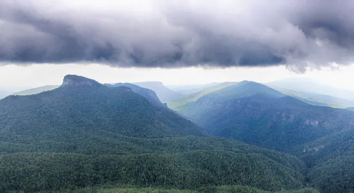
(Photo by Table Rock Seen From Hawksbill, photo by Charles & Maggie Boyer via CC BY 2.0)
While this segment of the MST might not have the tallest of the peaks or the most sought-after cascades, it has sweet summits and wondrous waterfalls in abundance. The promontories hikers can see here includes Bald Knob, Dobsons Knob, Shortoff Mountain, Table Rock, the Pinnacle, the Chimneys, and Hawksbill. The waterfalls are also frequent, with visits to Gragg Prong Falls, Hunt Fish Falls, Harper Falls, South Harper Falls, and Steels Creek Falls.
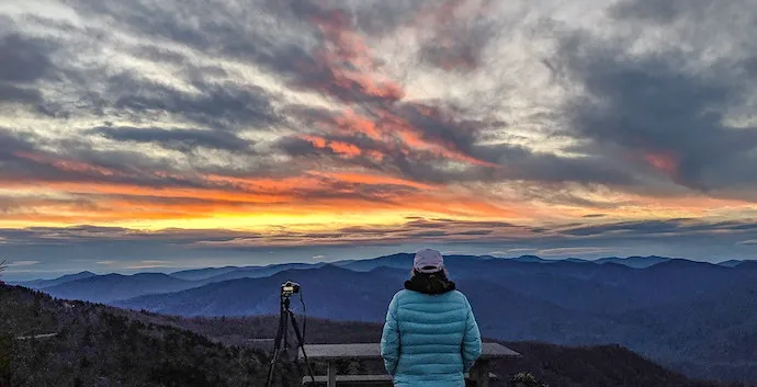
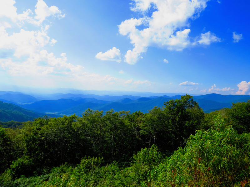
Pushing the tape to 90+ miles, the MST’s fifth segment moves through the region called the High Country, which includes some great NC ski resorts, several parks, and the beloved mountain towns of Blowing Rock and Boone.
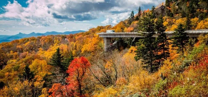
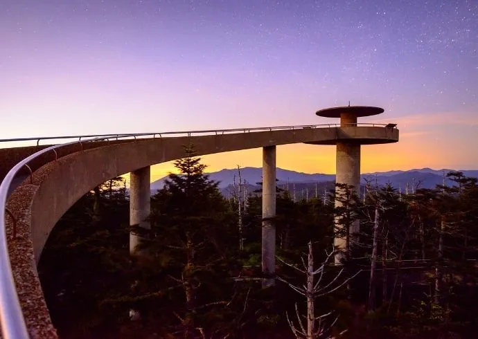
(Photo by Linn Cove Viaduct, photo by Bret Love & Mary Gabbett)
It’s somewhat ironic that one of the most photographed sections of the Blue Ridge Parkway features the road itself. But the Linn Cove Viaduct is just too cool to be ignored. This was actually the last section of the Parkway to be completed, and it wasn’t fully finished until 1983, nearly 50 years after the construction of the Parkway began. The viaduct– a raised section of road– was built this way in order to preserve the aesthetic beauty and environmental integrity of Grandfather Mountain. The Linn Cove Viaduct was assembled with 153 different 50-ton segments that lift the road for a stretch of 1,243 feet. Even now, nearly 40 years later, it’s considered a miraculous feat of engineering.
(Photo by Fall colors in Moses H. Cone Memorial Park, photo by Carl Tyer via Canva)
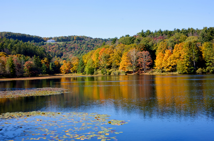
A stunning stop-off along the BRP, Moses H. Cone Memorial Park (Milepost 294) has a lot to offer visitors. It’s an amazing place for a picnic, whether the blanket is spread on the lawn of Flat Top Manor or carried down to the shore of Bass Lake. One of the park’s most unique features is the system of roadways winding through it. They’re suitable for horseback riders and horse-drawn carriages.
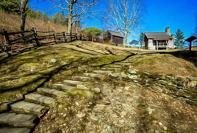
(Photo by Brinegar Cabin in Doughton Park, NC)
Doughton Park is the largest recreation area on the Blue Ridge Parkway, and its 7,000 acres spread from Milepost 244.7 (Basin Cove Overlook) to Milepost 238.5 (Brinegar Cabin). The park offers over 30 miles of trails, and the MST mostly piggybacks the Bluff Mountain Trail to skirt along the same ridge as the Parkway. Doughton Park has two 19th century cabins, a visitors center, extensive campground facilities, a huge picnic area, and the remains of a once-famous, seemingly always “about to reopen” eatery, Bluffs Restaurant.
The sixth segment of the Mountains-to-Sea Trail descends into the North Carolina Piedmont, tracing some 69.4 miles from the BRP’s Devil’s Garden Overlook all the way to Pilot Mountain.
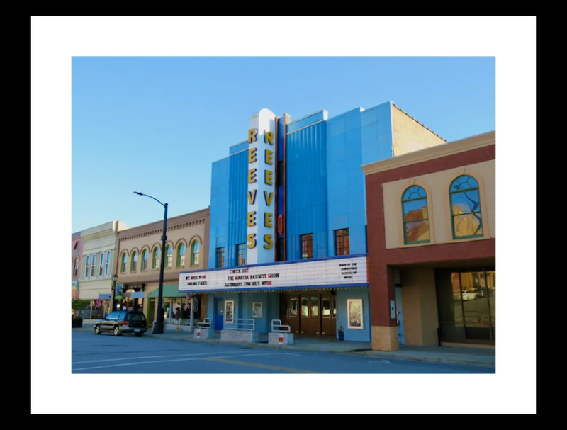
(Photo source unknown)
After hiking through so much wilderness, a proper trip to town might seem appealing. Lazy Downtown Elkin NC offers a wonderful way to ease into it. Elkin Creek passes through the heart of Historic Downtown Elkin, leading MST hikers right to Main Street. It’s home to great eateries (Southern on Main), tasty microbrews (Reeves Theater, Angry Troll Brewing), and plenty of antiques to explore (Elkin Antiques and Collectibles Mall). The Yadkin River flows just south of Downtown Elkin, and will be your guide for much of the remaining hike to Pilot Mountain.
Famed for its 600-foot rock face and 160-foot waterfall, Stone Mountain State Park is a beautiful location just down from the High Country, at the foot of the Blue Ridge Mountains. The park is crisscrossed with trout-filled creeks, dotted with waterfalls and swimming holes. It’s also embarrassingly stocked with stunning views of the surrounding landscape, with farmhouses on one side and mountain peaks on the other. In addition to the natural wonders you’ll find in Stone Mountain State Park, there are also historical sites, including a restored mid-19th century homestead and a tiny country church.
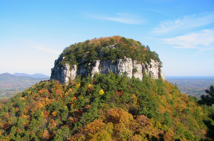
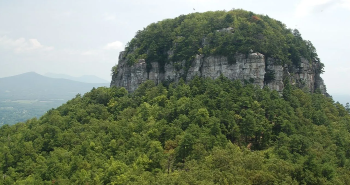
(Photo by Pilot Mountain, photo by NickS via Canva)
Pilot Mountain stands out prominently amongst the rolling hills of Surry County, North Carolina. It serves as a scenic backdrop for many local spots, particularly Mount Airy. Mount Airy is the town Andy Griffith was from. And, though it’s quite a bit larger these days, it was the inspiration for Mayberry, the fictional setting of The Andy Griffith Show. The Saura tribe of Native Americans once used the iconic Pilot Mountain’s geologically unique mountaintop as a navigational tool. In other words, it’s a great place to find yourself as the journey through Western North Carolina ends! Now the only question is… where to go next? –by Jonathon Engels